We have developed a downloadable desktop client for the Texas A&M Geoservices Geocoder. This
application allows you to process single addresses or databases of addresses in
the same way as the services provided by this site. Several more advanced
configuration options are available in this desktop application that offer
a bit more flexibility to the advanced user to control the geocoding strategy used.
We have not created any documentation for this tool yet, so if you have any
questions please just contact us.
The geocoding desktop client connects to the same geocoding engine on this site
using the Geocoding API we have made available.
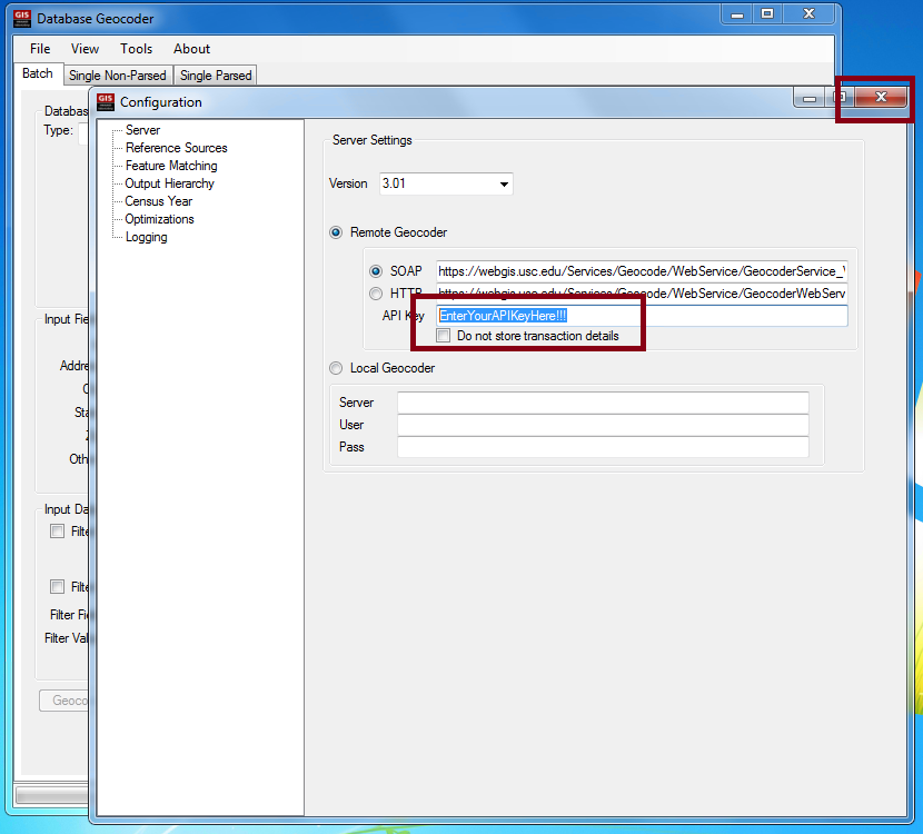
Making use of this API requires an API Key that is available on your
account profile page. You will
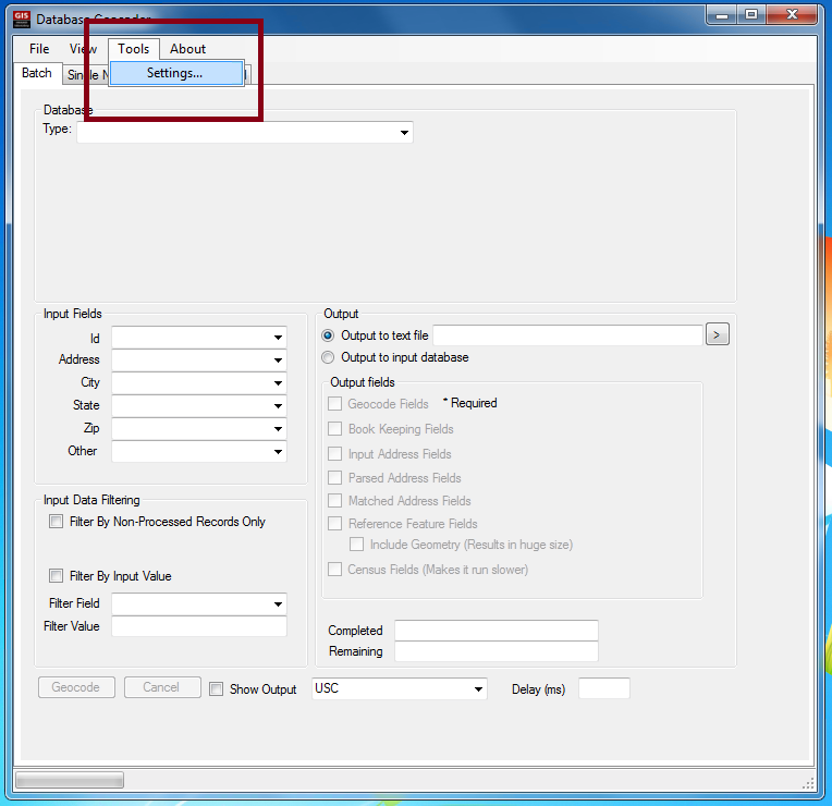
need to enter this information into the Setting page of the desktop geocoding client, on the server tab.
The geocoding desktop client is a work in progress, as is the geocoding engine and the geocoding API
so we can not guarantee that your results will be accurate or that the service will always be available
and will not change. In the event that the engine, service, or API changes, you should return to this site and
obtain the newest version of the geocoding desktop client.
If you can live with these shortcomings and the experimental nature of the geocoder, the service, and the
desktop application, download the latest version of the client from the links below.
If you run into any problems or have any suggestions or kudos, please let us know.
Prerequisites
Before you will be able to use the software without it crashing, you will need to install the
following three Microsoft programs that provide the underlying data connectivity functions and spatial data types used in the desktop geocoding client.
Required database drivers
1 - 2007 Office System Driver: Data Connectivity Components
2 - Microsoft SQL Server 2008 Native Client (x86)
or
(x64)
Required data types
3 - Microsoft SQL Server System CLR Types (x86)
or
(x64)
Sources
1 is part of Microsoft Office 2007,
while 2 and 3 are part of the
Microsoft SQL Server 2008 Feature Pack.
Application versions
Current version
Version 4.01 - 02/04/2013 - 64 Bit version
Updates in this version:
-
Update to use the new API Versions 4.01
-
Update to support Teradata input databases version 13.11.00
Previous version
Version 3.01 - 06/25/2012 - 32 Bit version
Update to use the new SOAP API Version 3.01
Version 2.95 - 11/22/2010 - 32 Bit version
Update to use the new SOAP API Version 2.95
Version 2.94 - 02/14/2010 - 32 Bit version
Update to use the new SOAP API Version 2.94
Version 2.92 - 11/04/2009
Update to use the new SOAP API Version 2.92
Version 2.91 - 09/29/2009
Update to use the new SOAP API Version 2.91
Version 2.9 - 09/10/2009
Update to use the new SOAP API Version 2.9
Version 2.7 - 05/15/2009
Update to use the new SOAP API Version 2.7
Version 2.6 - 05/11/2009
Update to use the SOAP API Version 2.6
Version 1.2 - 12/08/2008
Update to use the SOAP API Version 2.0
Version 1.1 - 10/22/2008
Initial pilot launch of the desktop client
Installation Troubleshooting
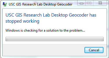
Solution - The directory where the program is installed needs write permissions to create a configuration file
-
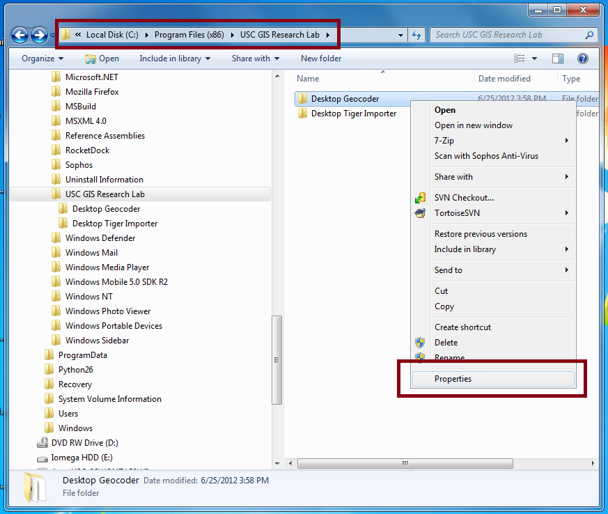
Browse to where the program is installed - This will most likely be C:\Program Files (x86)\USC GIS Research Lab
-
Right click the folder "Desktop Geocoder" and go to its properties
-
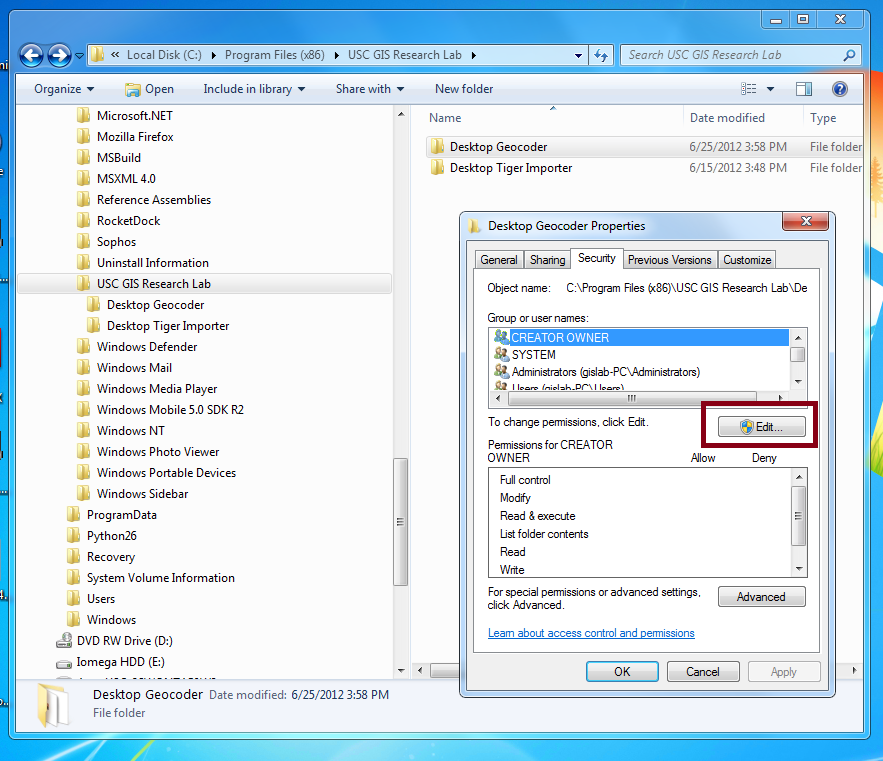
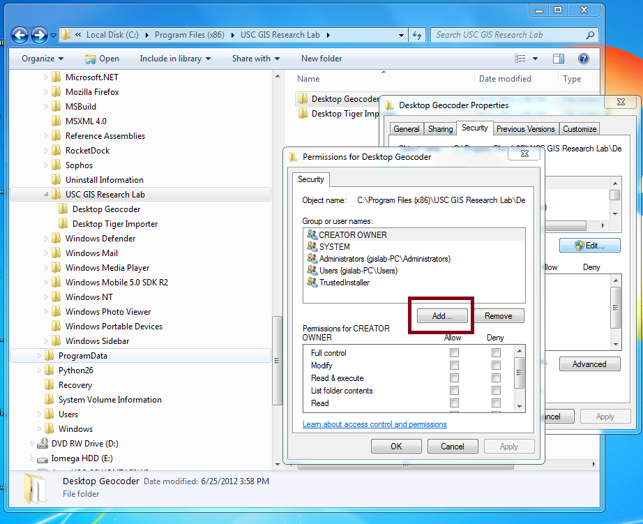
Go to the Security tab and click Edit
-
Click Add
-
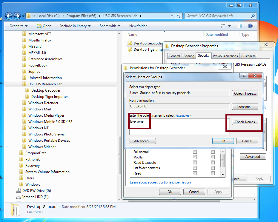
Type "everyone" (no quotes) and click Check Names, then click OK
-
Click the "Modify" checkbox, then click OK

Solution - Following the steps below will solve most Windows10 installation issues:
-
If unable to install SQL Server 2008 due to not being supported in Windows10:
-
Install Net Framework 3.5 in order to install SQL Server System CLR Types.
- Press “Windows Logo” + “R” keys on the keyboard.
- Type “appwiz.cpl” in the “Run” command box and press “ENTER”.
- In the “Programs and Features” window, click on the link “Turn Windows features on or off”.
- Check if the “.NET Framework 3.5 (includes .NET 2.0 and 3.0)” option is available in it.
- If yes, then enable it and then click on “OK”.
- Follow the on-screen instructions to complete the installation and restart the computer, if prompted.
-
If error "microsoft.ace.oledb.12.0 provider not registered" returned when loading an .mdb file:
Usage Tips
Symptom - When I try to geocode I get an error that the API key is missing
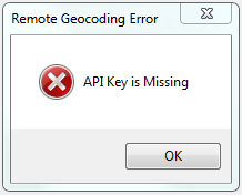
Solution - Enter your API Key from the Geoservices website in the Settings
-
Figure out what your API key is by checking your profile on the Geoservices site
-
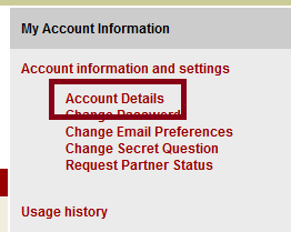
Click on the "MyAccount" link at the top of the Geoservices site to get to your account

-
Click on the "Account Details" link to see your details
-
Make a note of your API key

-
Start the WebGIS Desktop Geocoder and go to the Tools > Settings tab
-
Type in your API Key and close the settings window
