

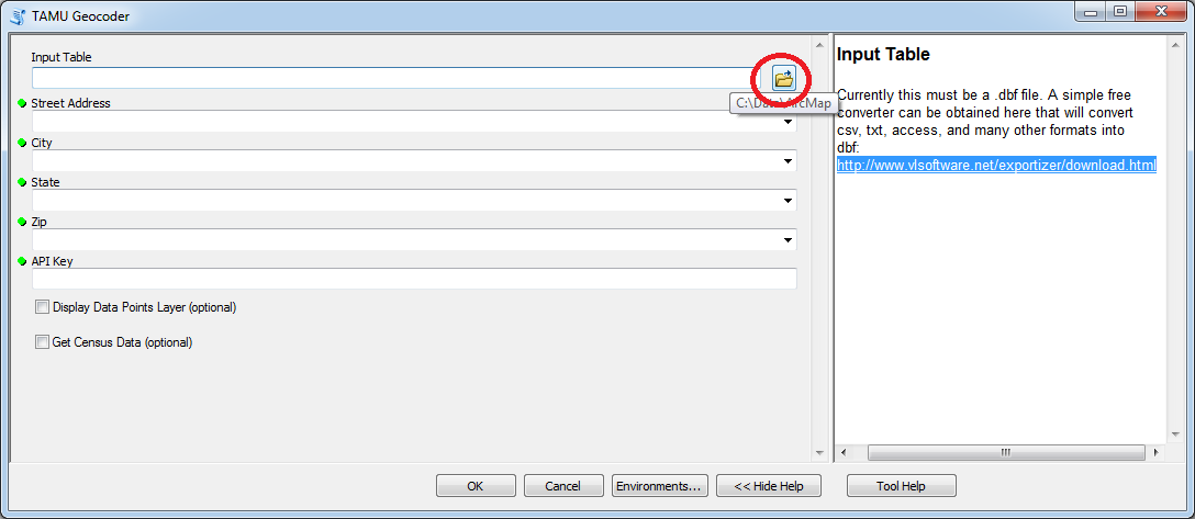
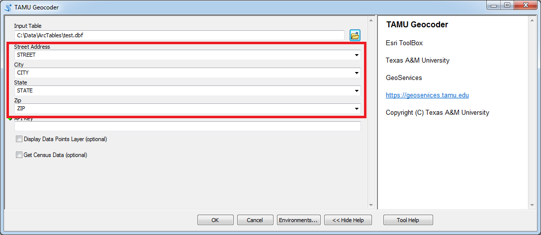
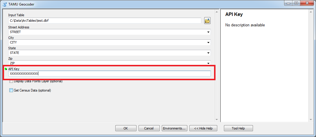
How to use the Geocoding Tool
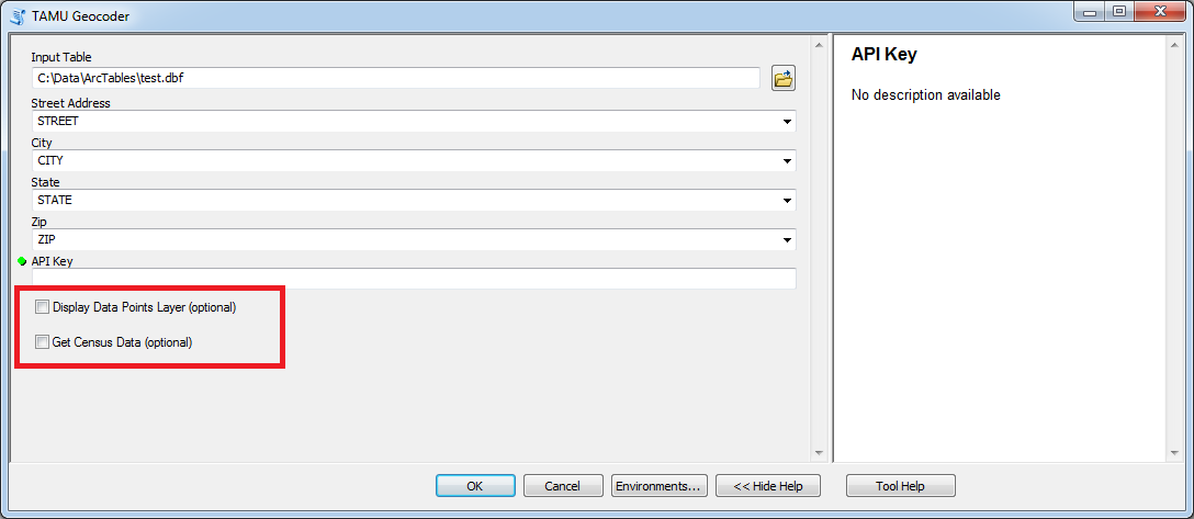
4. Select optional features as needed. Note that if you want to save the data points on a map you will need to manually save the feature layer added with the Display Data Points Layer option. See the 'How to' on saving the layer.
Click OK.
5. A new file with the geocoded results will be created with the following naming format:
originalFileName_Results.xxx where xxx is the extension type of the original file